Back to
Glacier NP
main page
ACCOMMODATIONS
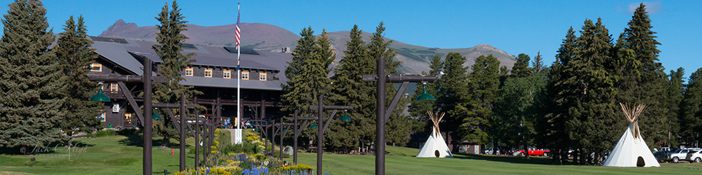
Inside the Park
Outside the Park
More Glacier National Park
ATTRACTIONS
Points of Interest
-Going to the Sun Road
-Lake McDonald
-Logan Pass
-Many Glacier
-Two Medicine
Viewpoints
-Loop Pullout
-Red Rock Point
-Wild Goose Island
VISITOR INFORMATION
Featured Web Sites
Map of Park Area
Map of Park
Visitor Centers
-Apgar
-Logan Pass
-St. Mary
Communities near Glacier National Park
Browning
Columbia Falls
East Glacier Park
Essex
Kalispell
St. Mary
West Glacier
Whitefish
Communities in the nearby
Flathead Valley
Bigfork
Coram
Columbia Falls
Hungry Horse
Kalispell
Lakeside
Polson
Ronan
Somers
Whitefish
Travel Article:
National Bison Range
Back to:
National
Parks in the Pacific Northwest
More Northwest Montana
Bitterroot Valley
Blackfeet Indian Res.
Clark Fork River
Flathead Valley
Kootenai Valley
Missoula Valley
Seeley Swan Valley
Montana Travel Regions and Maps:
Map
North Central
Map
Northeast
Map
Northwest
Map
South Central
Map
Southeast
Map
Southwest
Glacier National Park Accommodations
Outside the Park
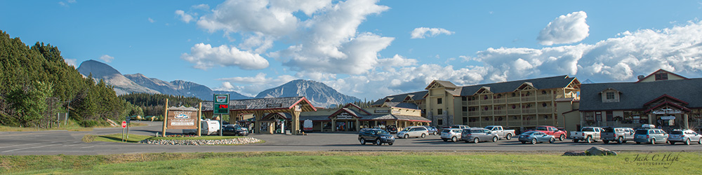
Outside the Park you will find a variety of hotels, motels, bed & breakfasts, cabins, cottages, lodges, ranches and resorts. Most of these facilities are located within nearby communities. Others are found scattered around the nearby area; usually alongside a main highway but away from town, sometimes off on a side road, or sitting beside a lake or river or nestled within a quiet forest grove.
To help you in your search, we have listed below several communities with lodging accommodations and other services catering to park visitors. Population figures, where given, are for incorporated cities and towns from the 1999 U.S. Census Estimate.
West
Side
(Park entrance is located just off US Highway 2 at West Glacier.)
West Glacier. US Highway 2, at park entrance.
Coram. 7 miles west of park entrance on US Highway 2.
Hungry Horse. 10 miles west of park entrance US Highway 2.
Columbia Falls. 15 miles west of park entrance US Highway 2. Population: 4,293.
Whitefish. MT Highway 93.
Kalispell. 28 miles west of park entrance US Highway 2. Population: 17,149.
South Side
US Highway 2
Essex. Near the southern most tip of the park on US Highway 2, 29 miles south of West Glacier and 26 miles west of East Glacier.
East Side
Babb. Northeast of the park on the Blackfeet Indian Reservation, 9 miles north of the St. Mary Visitor Center on US Highway 89.
St. Mary. On the eastern boundary of the park, 53 miles east of West Glacier at the east end of the Going-to-The-Sun Road and its junction with US Highway 89.
Browning. On the Blackfeet Reservation 31 miles east of St. Mary on US Highway 89.
East Glacier Park. Just outside the southeast corner of the park and on the Blackfeet Indian Reservation 55 miles east of West Glacier on US Highway 2 and 44 miles south of St. Mary via Browning and US Highway 89.
Go Northwest!
Bookstore
Best selection of books on the Northwest.
Click
here!
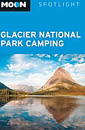 Moon
Spotlight Glacier National Park Camping by Becky Lomax. This compact
guide covers the region's best campsites. Each camp listing has at-a-glance
icons that indicate nearby trails, activities, hot springs and which campsites and
trails allow dogs. Also included are easy-to-follow maps and clear driving directions.
Order now...
Moon
Spotlight Glacier National Park Camping by Becky Lomax. This compact
guide covers the region's best campsites. Each camp listing has at-a-glance
icons that indicate nearby trails, activities, hot springs and which campsites and
trails allow dogs. Also included are easy-to-follow maps and clear driving directions.
Order now...
 The
Complete Guide to the National Park Lodges, 6th Edition by David L. Scott
and Kay W. Scott. This book is an insider's guide to finding the best lodges
throughout the United States-and to securing a reservation well in advance to eat the crowds.
Order now..
The
Complete Guide to the National Park Lodges, 6th Edition by David L. Scott
and Kay W. Scott. This book is an insider's guide to finding the best lodges
throughout the United States-and to securing a reservation well in advance to eat the crowds.
Order now..
 Moon
Glacier National Park, 6th Edition (Moon Handbooks) by Becky Lomax. Get
an insider's perspective on hiking the park's trails, unique trip strategies, a wildlife watching tour, a one
day Glacier tour, biking up Going-to-the-Sun Road and wildlife viewing.
Photographs and maps are included in this guide.
Order now...
Moon
Glacier National Park, 6th Edition (Moon Handbooks) by Becky Lomax. Get
an insider's perspective on hiking the park's trails, unique trip strategies, a wildlife watching tour, a one
day Glacier tour, biking up Going-to-the-Sun Road and wildlife viewing.
Photographs and maps are included in this guide.
Order now...
We appreciate your orders. They help keep
Go Northwest! online.
Northwest Books
from . . .
![]()
Shopping at
Go Northwest!
![]()
![]()
![]()
![]()