![]()
![]()
![]()
![]()
Back to
Washington Cascades
main page
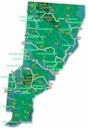
The town and road map of Washington's Cascades will help you locate cities, towns, attractions and points of interest.
Mountain Passes
Blewett Pass
Snoqualmie Pass
-Hiking
-Skiing
-Scenic Drives
Stevens Pass
-View Cam
White Pass
More
Cascades
North Cascades
Central Cascades
South Cascades
Novels set in the Enchantments
"Cup of Strength" by Charlotte Paul, 1958. Coming to the Snoqualmie Valley in search of the husband who deserted her, young Merrie Cowen makes a new life for herself in the brawling Northwest frontier of the 1890s.
Washington Travel Regions and Maps
Map
Cascade Mountains
Map
Northeast
Map
Northwest
Map
Olympic Peninsula
Map
Puget Sound
Map
San Juan Islands
Map
South Central
Map
Southeast
Map
Southwest
Mountain Passes
Snoqualmie Pass, elevation 3,022 feet, on I-90, is the lowest and most heavily traveled east-west highway crossing in Washington state. It is one of the state's two east-west highways with mountain passes open year-round. The other is Stevens Pass Highway, US 2.
Snoqualmie Pass offers easy access to a variety of recreational opportunities including hiking, backpacking, skiing, snowboarding and cross-country skiing. The pass is crossed by the popular Pacific Crest Trail, which runs from British Columbia, Canada to Mexico. Other trailheads abound at the Pass or along its approaches. Several ski areas populate the pass, with shuttle buses between ski areas. The winter visitor will find numerous condos and vacation rentals available for lodging as well as the popular ski resorts.
These numerous trailheads, ski slopes and the easy year-around access from Seattle and its suburbs makes the Snoqualmie Pass area a popular summer and winter recreational site for residents of Western Washington and the Puget Sound.
Stevens Pass, elevation 4,061 feet, is on US 2 - the Stevens Pass Greenway, and is one of two east-west highways with mountain passes open year-round in Washington State. The other is I-90, to the south, which crosses Snoqualmie Pass. The 105-mile Stevens Pass scenic byway winds through the rugged, forested Cascade Mountains and runs beside the wild and scenic Skykomish and Wenatchee rivers along most of its length. Year-round recreation opportunities include white-water rafting, hiking, skiing and auto touring. Travelers are advised to carry tire chains and monitor weather conditions during snow season.
Go Northwest!
Bookstore
Best selection of books on the Northwest.
Click
here!
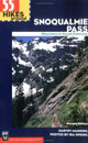 55
Hikes Around Snoqualmie Pass: Mountains to Sound Greenway, 2nd Edition
by Harvey Manning and Ira Spring. This book highlights destinations for
hikers who want to enjoy and preserve this important natural area
between Seattle and Ellensburg. From easy afternoon strolls to
challenging trails through the Cascades, each hike is described completely.
Order now...
55
Hikes Around Snoqualmie Pass: Mountains to Sound Greenway, 2nd Edition
by Harvey Manning and Ira Spring. This book highlights destinations for
hikers who want to enjoy and preserve this important natural area
between Seattle and Ellensburg. From easy afternoon strolls to
challenging trails through the Cascades, each hike is described completely.
Order now...
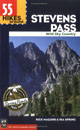 55
Hikes Around Stevens Pass: Wild Sky Area by Rick McGuire and Ira Spring.
New addition to the popular 100 Hikes in™ series and companion to the
successful 55 Hikes Around Snoqualmie Pass. Details mile by mile the views
along Stevens Pass Highway, a designated national scenic byway.
Order now...
55
Hikes Around Stevens Pass: Wild Sky Area by Rick McGuire and Ira Spring.
New addition to the popular 100 Hikes in™ series and companion to the
successful 55 Hikes Around Snoqualmie Pass. Details mile by mile the views
along Stevens Pass Highway, a designated national scenic byway.
Order now...
 Roads
to Trails Northwest Washington: Mount Baker-Snoqualmie National Forests
Roads
to Trails Northwest Washington: Mount Baker-Snoqualmie National Forests
by Ira Spring and Washington Trails Association. Mountaineer Books.
Order now...
 Snowshoe
Routes Washington, 3rd Edition (Mountaineers Books) by Can Nelson. This
guide features 100 routes categorized in nine sections, and information
on camping options, parking, dog-friendly routes and avalanche risk.
Color photographs and at-a-glance icons are also included.
Order now...
Snowshoe
Routes Washington, 3rd Edition (Mountaineers Books) by Can Nelson. This
guide features 100 routes categorized in nine sections, and information
on camping options, parking, dog-friendly routes and avalanche risk.
Color photographs and at-a-glance icons are also included.
Order now...
 100
Classic Backcountry Ski & Snowboard Routes In Washington: Description of
Mountaineers Books 100 Classic Backcountry Ski & Snowboard Routes In
Washington by Rainer Burdorfer. More than 100 routes and tours for
intermediate to advanced alpine and Nordic skiers and snowboarders,
Burgdorfer's guide is the definitive reference for the Cascade region.
Order now...
100
Classic Backcountry Ski & Snowboard Routes In Washington: Description of
Mountaineers Books 100 Classic Backcountry Ski & Snowboard Routes In
Washington by Rainer Burdorfer. More than 100 routes and tours for
intermediate to advanced alpine and Nordic skiers and snowboarders,
Burgdorfer's guide is the definitive reference for the Cascade region.
Order now...
We appreciate your orders. They help keep
Go Northwest! online.
Northwest Books
from . . .
![]()
Shopping at
Go Northwest!
![]()
![]()
![]()
![]()