![]()
![]()
![]()
Where to stay and
what to do in
Maple Falls
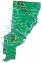
The town and road map of Washington's Cascades will help you locate cities, towns, attractions and points of interest.
Nearby Cities and Towns
Abbotsford BC, 22 miles
Bellingham WA, 28
miles
Concrete, 57 miles
Glacier, 7 miles
Langley BC, 38 miles
Mt. Baker, 26 miles
Cities and Towns of the North Cascades
North Cascades Visitor Information
More Cascades
North Cascades
Central Cascades
South Cascades
Washington Travel Regions and Maps
Map
Cascade Mountains
Map
Northeast
Map
Northwest
Map
Olympic Peninsula
Map
Puget Sound
Map
San Juan Islands
Map
South Central
Map
Southeast
Map
Southwest
Maple Falls, Washington
Maple Falls is a small community located approximately 25 miles east of Bellingham and 30 minutes south of the Canadian Border on the scenic Mt. Baker Highway. On the route to North Cascades National Park, Maple Falls is an ideal spot to stop when seeking peace and quiet.
Nestled in the foothills of Mt. Baker provides the area with breathtaking scenery and many outdoor activities such as climbing, snow skiing, hiking and biking. Silver Lake Park adds even more recreation including fishing, boating and swimming.
To enjoy the scenic vistas, drive one of the byways or simply just sit back in Maple Falls and drink in nature's beauty.
![]()
Go Northwest!
Bookstore
Best selection of books on the Northwest.
Click here!
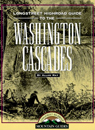 Highroad
Guide to the Washington Cascades by Allan May. This guide contains
detailed trail instructions and 50 maps in an easy to use format leading you
to the best sites of Washington's Cascade Mountains.
Order now...
Highroad
Guide to the Washington Cascades by Allan May. This guide contains
detailed trail instructions and 50 maps in an easy to use format leading you
to the best sites of Washington's Cascade Mountains.
Order now...
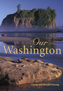 Our
Washington by George Ostertag and Rhonda Ostertag. This book of
photographs highlights every aspect of Washington's beauty including the
mountains, lush rainforests, the frontier heritage as well as the urban
Seattle and Spokane. Learn about the
geography, history
and culture.
Order now...
Our
Washington by George Ostertag and Rhonda Ostertag. This book of
photographs highlights every aspect of Washington's beauty including the
mountains, lush rainforests, the frontier heritage as well as the urban
Seattle and Spokane. Learn about the
geography, history
and culture.
Order now...
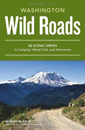 Wild
Roads Washington: 80 Scenic Drives to Camping, Hiking Trails, and Adventures
by Seabury Blair Jr. This adventure guidebook details the forest roads of
Washington with information on hikes off each route as well as driving
routes that provide scenic vistas almost as good as those reached by foot.
Order now...
Wild
Roads Washington: 80 Scenic Drives to Camping, Hiking Trails, and Adventures
by Seabury Blair Jr. This adventure guidebook details the forest roads of
Washington with information on hikes off each route as well as driving
routes that provide scenic vistas almost as good as those reached by foot.
Order now...
 Moon
Washington, 11th Edition (Moon Handbooks) by Matthew Lombardi. This
travel writer and Seattle resident gives an insider's view of everything
the Evergreen State has to offer such as great places to eat, scenic
drives and volunteer vacations. Discover Seattle's arts and culture,
details on climbing Mt Rainier and so much more.
Order now...
Moon
Washington, 11th Edition (Moon Handbooks) by Matthew Lombardi. This
travel writer and Seattle resident gives an insider's view of everything
the Evergreen State has to offer such as great places to eat, scenic
drives and volunteer vacations. Discover Seattle's arts and culture,
details on climbing Mt Rainier and so much more.
Order now...
 Hidden
Washington: Including Seattle, Puget Sound, San Juan Islands, Olympic Peninsula,
Cascades and Columbia River Gorge (Hidden Travel) by Eric Lucas. This author
gets to know each community by going from neighborhood to neighborhood. This
book will take you to all the great spots while describing both the famous
attractions and hidden favorites.
Order now...
Hidden
Washington: Including Seattle, Puget Sound, San Juan Islands, Olympic Peninsula,
Cascades and Columbia River Gorge (Hidden Travel) by Eric Lucas. This author
gets to know each community by going from neighborhood to neighborhood. This
book will take you to all the great spots while describing both the famous
attractions and hidden favorites.
Order now...
We appreciate your orders. They help keep
Go Northwest! online.
Northwest Books
from . . .
![]()
Shopping at
Go Northwest!
![]()
![]()
![]()
![]()