Back to
Washington Cascades
main page
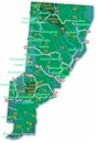
The town and road map of Washington's Cascades will help you locate cities, towns, attractions and points of interest.
North Cascades Visitor Information
Cities and Towns of the North Cascades
Chelan
Concrete
Darrington
Glacier
Manson
Maple Falls
Mazama
Mt. Baker
Stehekin
Twisp
Winthrop
Travel Articles
Hike to Hidden Lake Peaks
Rattlesnake Ridge Hike
More
Cascades
North Cascades
Central Cascades
South Cascades
Mountain Passes
Blewett Pass
Snoqualmie Pass
Stevens Pass
National Forests
Mt. Baker-Snoqualmie
Okanogan-Wenatchee
National Parks
North Cascades
National Recreation Areas
Lake Chelan
Mt Baker
Ross Lake
National Wilderness Areas
Boulder River
Glacier Peak
Lake Chelan-Sawtooth
Mt Baker
Noisy-Diobsud
Pasayten
Scenic Drives
Cascade Loop
Mt Baker Highway
Ski Areas
Loup Loup
Methow Valley
Mt. Baker
Sitzmark Lifts
Sun Mountain
Washington Travel Regions and Maps
Map
Cascade Mountains
Map
Northeast
Map
Northwest
Map
Olympic Peninsula
Map
Puget Sound
Map
San Juan Islands
Map
South Central
Map
Southeast
Map
Southwest
The North Cascades
The Mountains of the North Cascades
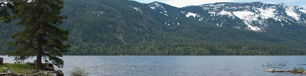
The defining features of The North Cascades' are its impressive mountains including Mount Baker, Glacier Peak, and Mount Shuksan; several National Wilderness Areas and National Recreation Areas, Ross and Chelan lakes and the rugged North Cascades National Park.
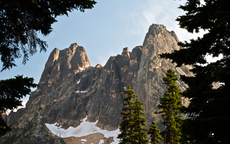
Easily spotted from the North Cascades Highway, State Route 20, Liberty Bell Mountain has an 7720 feet/2353 meters elevation. Photo by Jack High.
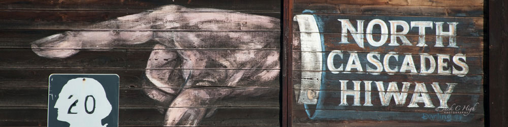
North Cascades Highway
The principle highway serving the area is Route 20, the North Cascades Highway. The seasonal highway usually is open mid-April through mid-November. For highway closure information contact forest service offices for the Mount Baker - Snoqualmie National Forest, the Okanogan National Forest or the North Cascades National Park.
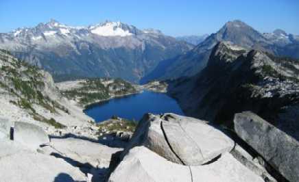 Hidden Lake Peaks. Boston Peak and Sahale Peak at
upper left. Hidden Lake at center. Photo by Brian High.
Hidden Lake Peaks. Boston Peak and Sahale Peak at
upper left. Hidden Lake at center. Photo by Brian High.
North Cascades Cities and Towns
The approach from the west passes through the towns of Concrete, Rockport and Marblemount, which lie along the Skagit River. The Skagit is home to a thriving population of Bald Eagles and the three communities celebrate the return of these magnificent birds with an annual Upper Skagit Bald Eagle Festival usually held in late January or early February.
The traveler approaching from the east will find the towns of Winthrop, Mazama and Conconully; each of which retains an air of the wild west with its saloons, trading posts and classic hotels. Winthrop in particular is a popular destination known for it's western theme.
Cascade Loop Scenic Highway
A popular tour is the Cascade Loop Scenic Highway. The circular route presents grand alpine views and high mountain passes along the North Cascades Highway, semi-arid orchard lands along the Columbia River and the beautiful scenery presented by the waters of Puget Sound.
Go Northwest!
Bookstore
Best selection of books on the Northwest.
Click here!
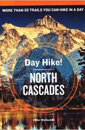 Day
Hike! North Cascades, 3rd Edition: The Best Trails You Can Hike in a Day
by Mike McQuaide. Explore the scenic North Cascades National Park by
hiking. This guide covers 59 hikes and rates each trail. Photographs,
topographical maps and trail descriptions are all included.
Order now...
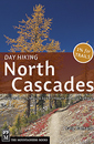
Day
Hike! North Cascades, 3rd Edition: The Best Trails You Can Hike in a Day
by Mike McQuaide. Explore the scenic North Cascades National Park by
hiking. This guide covers 59 hikes and rates each trail. Photographs,
topographical maps and trail descriptions are all included.
Order now...
 Day
Hiking North Cascades by Craig Romano. This compact guide covers t a
broad range of hiking options. This is the most up-to-date guide for the
area, organized along highway and other travel corridors with an emphasis on
trails that are 12 miles or less, round-trip.
Order now...
Day
Hiking North Cascades by Craig Romano. This compact guide covers t a
broad range of hiking options. This is the most up-to-date guide for the
area, organized along highway and other travel corridors with an emphasis on
trails that are 12 miles or less, round-trip.
Order now...
 Hiking
the North Cascades, 2nd Edition by Erik Molvar. This comprehensive guide
is your passport to one of the most beautiful and truly wild reaches of
North America describing 105 of the region's best and most varied hikes,
from a few choice short excursions to a whole host of day trips and
overnight treks.
Order now...
Hiking
the North Cascades, 2nd Edition by Erik Molvar. This comprehensive guide
is your passport to one of the most beautiful and truly wild reaches of
North America describing 105 of the region's best and most varied hikes,
from a few choice short excursions to a whole host of day trips and
overnight treks.
Order now...
 Moon
Spotlight Washington's Northern Cascades Camping & Hiking by Tom
Stienstra and Scott Leonard. This compact guide covers the region's camping
and hiking sights with at-a-glance icons for the nearby activities. Hiking descriptions,
easy-to-follow maps, and clear driving directions are included for each camp.
Order now...
Moon
Spotlight Washington's Northern Cascades Camping & Hiking by Tom
Stienstra and Scott Leonard. This compact guide covers the region's camping
and hiking sights with at-a-glance icons for the nearby activities. Hiking descriptions,
easy-to-follow maps, and clear driving directions are included for each camp.
Order now...
 Selected
Climbs in the Cascades Volume II by Jim Nelson and Peter Potterfield.
Features 100 routes, including top favorite sport and crag climbing areas.
Illustrated throughout with black and white photographs, several with route
overlays. Highlights fun, quality climbs for all skill levels.
Order now...
Selected
Climbs in the Cascades Volume II by Jim Nelson and Peter Potterfield.
Features 100 routes, including top favorite sport and crag climbing areas.
Illustrated throughout with black and white photographs, several with route
overlays. Highlights fun, quality climbs for all skill levels.
Order now...
 Highroad
Guide to the Washington Cascades by Allan May. This guide contains
detailed trail instructions and 50 maps in an easy to use format leading
you to the best sites of Washington's Cascade Mountains.
Order now...
Highroad
Guide to the Washington Cascades by Allan May. This guide contains
detailed trail instructions and 50 maps in an easy to use format leading
you to the best sites of Washington's Cascade Mountains.
Order now...
We appreciate your orders. They help keep
Go Northwest! online.
Northwest Books
from . . .
![]()
Shopping at
Go Northwest!
![]()
![]()
![]()
![]()