![]()
![]()
![]()
![]()
Snoqualmie Pass
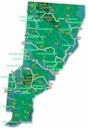
The town and road map of Washington's Cascades will help you locate cities, towns, attractions and points of interest.
Nearby Cities and Towns
Cle Elum
Ellensburg
North Bend
Snoqualmie
Mountain Passes
Blewett Pass
Snoqualmie Pass
Stevens Pass
White Pass
National Forests
Mt. Baker-Snoqualmie
Okanogan-Wenatchee
National Wilderness Areas
Alpine Lakes
Boulder River
Henry M Jackson
Scenic Sights
Snoqualmie Falls
More
Cascades
North Cascades
Central Cascades
South Cascades
Washington Travel Regions and Maps
Map
Cascade Mountains
Map
Northeast
Map
Northwest
Map
Olympic Peninsula
Map
Puget Sound
Map
San Juan Islands
Map
South Central
Map
Southeast
Map
Southwest
Snoqualmie Pass
Snoqualmie Pass, elevation 3,022 feet, on I-90, is the lowest and most heavily traveled east-west highway crossing in Washington state. It is one of four Washington east-west highways with mountain passes open year-round. The other passes are are Stevens Pass, US Highway 2 and White Pass, US Highway 12.
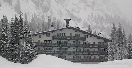
Snoqualmie Pass offers easy access to a variety of recreational opportunities including hiking, backpacking, skiing, snowboarding and cross-country skiing. The pass is crossed by the popular Pacific Crest Trail, which runs from British Columbia, Canada to Mexico. Other trailheads abound at the Pass or along its approaches. Several ski areas populate the pass, with shuttle buses between ski areas. The winter visitor will find numerous condos and vacation rentals available for lodging as well as the popular ski resorts.
These numerous trailheads, ski slopes and the easy year-around access from Seattle and its suburbs makes the Snoqualmie Pass area a popular summer and winter recreational site for residents of Western Washington and the Puget Sound.
VISITOR INFORMATION
Snoqualmie Pass View Camera
Department of Transportation site featuring live video feeds from five
Snoqualmie Pass cameras updated every 90 seconds to 12 minutes depending
upon the view selected. Also, links to
road
conditions report on each of the Washington mountain passes.
Scenic Drives
Mountains to Sound Greenway
A Scenic Byways site describing the I-90 corridor between the Cascade
Mountains crest on the east and Alki Point on the west. Rich in content
and descriptions of historical, recreational and scenic points of
interest.
![]()
Go Northwest!
Bookstore
Best selection of books on the Northwest.
Click here!
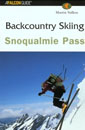 Backcountry
Skiing Snoqualmie Pass by Martin Volken. Just an hour east of Seattle,
Washington, Snoqualmie Pass provides easy access to rugged glaciated
mountains with deep snow and terrain for anyone with strong intermediate to
expert skiing skills. Swiss mountain guide, ski mountaineer, and author
Martin Volken supplies information on twenty-eight single-day and multiday
excursions.
Order now...
Backcountry
Skiing Snoqualmie Pass by Martin Volken. Just an hour east of Seattle,
Washington, Snoqualmie Pass provides easy access to rugged glaciated
mountains with deep snow and terrain for anyone with strong intermediate to
expert skiing skills. Swiss mountain guide, ski mountaineer, and author
Martin Volken supplies information on twenty-eight single-day and multiday
excursions.
Order now...
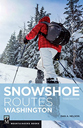 Snowshoe
Routes Washington, 3rd Edition (Mountaineers Books) by Can Nelson. This
guide features 100 routes categorized in nine sections, and information
on camping options, parking, dog-friendly routes and avalanche risk.
Color photographs and at-a-glance icons are also included.
Order now...
Snowshoe
Routes Washington, 3rd Edition (Mountaineers Books) by Can Nelson. This
guide features 100 routes categorized in nine sections, and information
on camping options, parking, dog-friendly routes and avalanche risk.
Color photographs and at-a-glance icons are also included.
Order now...
 55
Hikes Around Snoqualmie Pass: Mountains to Sound Greenway, 2nd Edition
by Harvey Manning and Ira Spring. This book highlights destinations for
hikers who want to enjoy and preserve this important natural area between
Seattle and Ellensburg. From easy afternoon strolls to challenging trails
through the Cascades, each hike is described completely.
Order now...
55
Hikes Around Snoqualmie Pass: Mountains to Sound Greenway, 2nd Edition
by Harvey Manning and Ira Spring. This book highlights destinations for
hikers who want to enjoy and preserve this important natural area between
Seattle and Ellensburg. From easy afternoon strolls to challenging trails
through the Cascades, each hike is described completely.
Order now...
 Day
Hiking: Snoqualmie Region by Dan Nelson and Alan L. Bauer. The
Mountaineers Books introduces its new Day Hiking guidebook series, written
by Northwest residents with impressive hiking resumes. These guides provide
accurate information in attractive, high-quality packaging and are infused
with the environmental ethic that distinguishes The Mountaineers Books from
other outdoor publishers.
Order now...
Day
Hiking: Snoqualmie Region by Dan Nelson and Alan L. Bauer. The
Mountaineers Books introduces its new Day Hiking guidebook series, written
by Northwest residents with impressive hiking resumes. These guides provide
accurate information in attractive, high-quality packaging and are infused
with the environmental ethic that distinguishes The Mountaineers Books from
other outdoor publishers.
Order now...
 Roads
to Trails Northwest Washington: Mount Baker-Snoqualmie National Forests
Roads
to Trails Northwest Washington: Mount Baker-Snoqualmie National Forests
by Ira Spring and Washington Trails Association. Mountaineer Books.
Order now...
We appreciate your orders. They help keep
Go Northwest! online.
Northwest Books
from . . .
![]()
Shopping at
Go Northwest!
![]()
![]()
![]()
![]()