![]()
![]()
![]()
![]()
Back to
Southern Oregon
main page
Cities and Towns of Southern Oregon
Applegate Valley
Ashland
Canyonville
Cave Junction
Idleyld Park
Grants Pass
Jacksonville
Klamath Falls
Medford
Merlin
Rogue River
Roseburg
Talent
More Oregon
ACTIVITIES
Snow Skiing
Tours
Tour Operators
Whitewater Rafting
ATTRACTIONS
Lighthouses
--Haceta Head
FOOD AND BEVERAGE
Wine Country
VISITOR INFORMATION
Cities and Towns
Map of Oregon
Oregon Travel Regions and Maps:
Map
Cascade Mountains
Map
Central
Map
Coast
Map
Columbia River
Map
Northeast
Map
Portland Area
Map
Southern
Map
Willamette Valley
Southern Oregon
Map
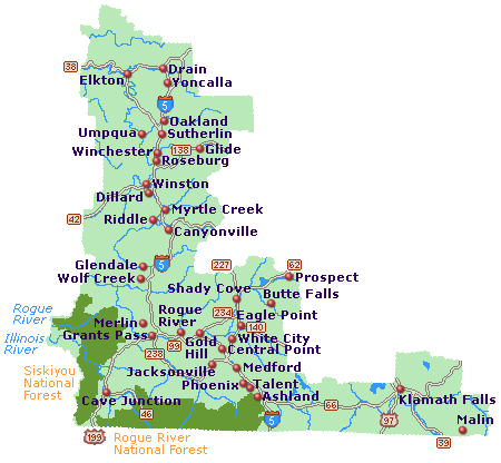
This map of Southern Oregon shows the highways, cities, towns plus the Rogue River and Siskiyou National Forests. Click on any of the cities such as Ashland, Grants Pass or Medford for more information about the area as well as what to see and do and where to stay.
This map of Southern Oregon shows the major interstates and state highways, cities and towns. Find scenic wilderness areas in one of the National Forests (Rogue River and Siskiyou). Click on any city or town, such as Ashland, Grants Pass or Medford, to find more information on accommodations and lodging, activities and outdoor recreation, attractions, food and beverage, visitor information and shopping venues. Utilize the left column to find more information on Southern Oregon and more Oregon maps.
Go Northwest!
Bookstore
Best selection of books on the Northwest.
Click here!
 Moon
Spotlight Oregon's Southern Cascades Camping & Hiking by Sean Patrick Hill
and Tom Stienstra. Camp listings have at-a-glance icons indicating nearby
trails, swimming, fishing, boating, canoeing, kayaking, and hot springs. Hiking
descriptions include distance, estimated hiking time, and a rating for
difficulty, easy-to-follow maps and clear driving directions area.
Order now...
Moon
Spotlight Oregon's Southern Cascades Camping & Hiking by Sean Patrick Hill
and Tom Stienstra. Camp listings have at-a-glance icons indicating nearby
trails, swimming, fishing, boating, canoeing, kayaking, and hot springs. Hiking
descriptions include distance, estimated hiking time, and a rating for
difficulty, easy-to-follow maps and clear driving directions area.
Order now...
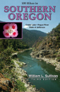 100
Hikes in Southern Oregon by William L. Sullivan. This guide to Southern
Oregon proves there's more to this scenic region than Crater Lake, the Rogue
River, and Mt. Shasta. Discover a hot springs in the hills behind Roseburg, a
wildflower mecca near Ashland, and a hidden lake basin in the Trinity Alps. The
book describes hikes for families and plenty of options for backpackers,
mountain bikers, and equestrians.
Order now...
100
Hikes in Southern Oregon by William L. Sullivan. This guide to Southern
Oregon proves there's more to this scenic region than Crater Lake, the Rogue
River, and Mt. Shasta. Discover a hot springs in the hills behind Roseburg, a
wildflower mecca near Ashland, and a hidden lake basin in the Trinity Alps. The
book describes hikes for families and plenty of options for backpackers,
mountain bikers, and equestrians.
Order now...
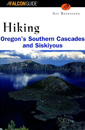 Hiking
Oregon's Southern Cascades & Siskiyous (Regional Hiking Series) by Art Bernstein. Use this guide for
up-to-date trail information, accurate directions to popular as well as
less-traveled trails, difficulty ratings for each hike, detailed trail maps, and
zero-impact camping tips.
Order now...
Hiking
Oregon's Southern Cascades & Siskiyous (Regional Hiking Series) by Art Bernstein. Use this guide for
up-to-date trail information, accurate directions to popular as well as
less-traveled trails, difficulty ratings for each hike, detailed trail maps, and
zero-impact camping tips.
Order now...
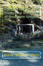 Shorty's
Not So Lost Mines and Treasures of Southern Oregon by Linda Owen. A
pictorial walk through the Gold Rush days of Southern Oregon. Pictures of old
mines, with GPS coordinates, mapping coordinates, and descriptions of each. Also
Lost Treasure Legends, and stories from the past. A Reference section with more
than 3000 mines and quarries in 5 counties.
Order now...
Shorty's
Not So Lost Mines and Treasures of Southern Oregon by Linda Owen. A
pictorial walk through the Gold Rush days of Southern Oregon. Pictures of old
mines, with GPS coordinates, mapping coordinates, and descriptions of each. Also
Lost Treasure Legends, and stories from the past. A Reference section with more
than 3000 mines and quarries in 5 counties.
Order now...
We appreciate your orders. They help keep
Go Northwest! online.
Northwest Books
from . . .
![]()
Shopping at
Go Northwest!
![]()
![]()
![]()
![]()