![]()
![]()
![]()
![]()
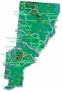
The town and road map of Washington's Cascades will help you locate cities, towns, attractions and points of interest.
More Cities and Towns of the South Cascades
Ashford
Cougar
Crystal Mountain
Eatonville
Elbe
Enumclaw
Greenwater
Mineral
Packwood
Stevenson
Randle
Trout Lake
Mountain Passes
Blewett Pass
Snoqualmie Pass
Stevens Pass
White Pass
National Forests
Gifford
Pinchot National Forest
National Parks
Mount Rainier
Mount. St. Helens
National Wilderness Areas
Clearwater
Goat Rocks
Indian
Heaven
Mt Adams
Norse Peak
Tatoosh
Trapper
Creek
William
Douglas
Scenic Drives
White Pass Scenic Byway
Ski Areas
Crystal Mountain
Mt Tahoma
White Pass
More Cascades
North Cascades
Central Cascades
South Cascades
White Pass
White Pass, elevation 4500 feet, on Highway 12, is the southern most pass through the Cascade Mountains in Washington State. It is on one of four Washington east-west passes. The other three are Stevens Pass on US Highway 2, Snoqualmie Pass on I-90 and North Cascades Pass along SR 20.
White Pass is generally open year round. It sometimes has to close for a few hours for avalanche control work or to tow vehicles that lost control in the snow. Snow chains are often required from November through May.
The nearest towns to White Pass on Highway 12 are Rimrock 15 miles to the east and Packwood 20 miles to the west. Both towns have travelers' amenities. Rimrock is a small resort town. Packwood is a midsize town with a small craft airport (55S).
White Pass is an entry portal to the White Pass Ski Area for snow skiing and snowboarding, Mt Rainier National Park, the Mt Adams Wilderness Area, Gifford Pinot National Forest and Okanogan-Wenatchee National Forest. These areas provide many outdoor recreational activities including: camping, hiking, fishing, boating, hunting for deer and elk, snowmobiling, dirt biking, motorcycling, wildflower and wildlife observation, bird watching, biking, golf, hang gliding, horseback riding, off-roading, river rafting, rock climbing, waterskiing and wind surfing.
Recommended side trips off Highway 12 near White Pass are: rainforests and waterfalls in Mt Rainier National Park, devastation after the 1980 eruption of Mt St Helens, Oak Creek Feeding Station for wildlife observation, spring wildflowers in Big Bottom Valley, the floating forest at Spirit Lake, the Cispus River area, Walupt Lake, and the Chinook Scenic Byway.
To get to White Pass from Seattle or Portland, take exit 68 east off I-5. On the way up to White Pass, Highway 12 goes through: Lewis and Clark State Park, Matilda Jackson State Park, Ethel, Salkum, Mayfield Lake State Park, Mossyrock, Ike Kinswa State Park, Morton, Glenoma, Randle, and Packwood. After White Pass but still in on the White Pass Scenic Byway are: the Rimrock Lake area, Rimrock Retreat, the Oak Creek Wildlife Area, and Naches. The Byway is 124 miles long.
White Pass View Camera
Department of Transportation site featuring live video feeds of White Pass cameras updated every 20 minutes. Also, links to
road conditions report on each of the Washington mountain passes.
White Pass Ski Area. 48935 Highway 12, White Pass, WA 98937. Phone: 509-672-3101; Snowline: 509-672-3100.
White Pass Scenic Byway
Located midway between Puget Sound and the Columbia River on Highway 12.
![]()
Go Northwest!
Bookstore
Best selection of books on the Northwest.
Click here!
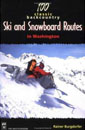 100
Classic Backcountry Ski & Snowboard Routes In Washington: Description of
Mountaineers Books 100 Classic Backcountry Ski & Snowboard Routes In
Washington by Rainer Burdorfer. More than 100 routes and tours for
intermediate to advanced alpine and Nordic skiers and snowboarders,
Burgdorfer's guide is the definitive reference for the Cascade region.
Order now...
100
Classic Backcountry Ski & Snowboard Routes In Washington: Description of
Mountaineers Books 100 Classic Backcountry Ski & Snowboard Routes In
Washington by Rainer Burdorfer. More than 100 routes and tours for
intermediate to advanced alpine and Nordic skiers and snowboarders,
Burgdorfer's guide is the definitive reference for the Cascade region.
Order now...
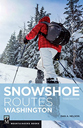 Snowshoe
Routes Washington, 3rd Edition (Mountaineers Books) by Can Nelson. This
guide features 100 routes categorized in nine sections, and information
on camping options, parking, dog-friendly routes and avalanche risk.
Color photographs and at-a-glance icons are also included.
Order now...
Snowshoe
Routes Washington, 3rd Edition (Mountaineers Books) by Can Nelson. This
guide features 100 routes categorized in nine sections, and information
on camping options, parking, dog-friendly routes and avalanche risk.
Color photographs and at-a-glance icons are also included.
Order now...
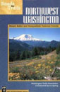 Roads
to Trails Northwest Washington: Mount Baker-Snoqualmie National Forests
Roads
to Trails Northwest Washington: Mount Baker-Snoqualmie National Forests
by Ira Spring and Washington Trails Association. Mountaineer Books.
Order now...
We appreciate your orders. They help keep
Go Northwest! online.
Northwest Books
from . . .
![]()
Shopping at
Go Northwest!
![]()
![]()
![]()
![]()