![]()
![]()
![]()
![]()
Back to
Mount Rainier NP
main page
More Mount Rainier
Description of Park
History of Park
Map of Area
Map of Park
Rainier the Mountain
Links
ACCOMMODATIONS
Inside the Park
Outside the Park
ATTRACTIONS
Museums
Scenic Sites
Nearby Cities and Towns
Ashford, 23 miles
Auburn, 62 miles
Buckley, 59 miles
Crystal Mountain, 46 miles
Eatonville, 44 miles
Elbe, 31 miles
Enumclaw, 63 miles
Greenwater, 19 miles
Mineral, 19 miles
Morton, 30 miles
Packwood, 29 miles
Randle, 48 miles
Tacoma, 60 miles
Yakima, 74 miles
More
Volcanoes
More Cascades
North Cascades
Central Cascades
South Cascades
Washington Travel Regions and Maps
Map
Cascade Mountains
Map
Northeast
Map
Northwest
Map
Olympic Peninsula
Map
Puget Sound
Map
San Juan Islands
Map
South Central
Map
Southeast
Map
Southwest
Description of the Park
Mount Rainier National Park was designed from a master plan which included such things as roads with scenic lookouts, trails and visitor centers. The roads were carefully engineered to make the least impact on the landscape, so you will notice they are narrow, and trees grow close. This creates a wonderful atmosphere to quickly transport you beyond the reminders of the nearby urban belt and bring you to the many beauties of the park which are easily accessed in short walks that ring the mountain. The further you are willing to hike, of course, the more you will see of the views, vegetation, wildlife, rivers, waterfalls, springs and canyons.
 The
park has more than 300 miles of trails that are usually snow-free from
mid-July through September. They range from short walks from viewpoints and
visitor centers to the 93-mile Wonderland Trail which completely encircles
the mountain. A circuit of the latter takes about 10-14 days. There are a
number of self-guiding nature walks. Ask at the visitor centers about
naturalist talks and walks in summer, and snowshoe walks in winter. Horses
are allowed on 100 miles of the trails.
The
park has more than 300 miles of trails that are usually snow-free from
mid-July through September. They range from short walks from viewpoints and
visitor centers to the 93-mile Wonderland Trail which completely encircles
the mountain. A circuit of the latter takes about 10-14 days. There are a
number of self-guiding nature walks. Ask at the visitor centers about
naturalist talks and walks in summer, and snowshoe walks in winter. Horses
are allowed on 100 miles of the trails.
The mountain is encircled by old-growth forest, filled with majestic Douglas-fir, red cedar and western hemlock. In the wettest area of the park near Carbon River in the northwest, some botanists contend the vegetation is an example of temperate rain forest. In summer the Park puts on displays of wildflowers that carpet the sub-alpine meadows. The greening meadows follow the zone of contact between advancing springtime and retreating winter, up the mountain. The best time to see the flowers is mid-July to mid-August.
The area abounds with wildlife which is readily seen upon the open, sub-alpine landscape. You can usually see birds, marmots, chipmunks, chickarees, squirrels, pikas and deer without wandering too far. Elk and black bear are more elusive. To see mountain goats, you'll have to hike up to the high country where they live. If you are serious about seeing wildlife, you will need to be on the trails well before 11:00 am.
Go Northwest!
Bookstore
Best selection of books on the Northwest.
Click here!
 Mt.
Rainier: Adventures and Views by John Harlin III and James Martin. Photographer James Martin
captures the awesome beauty of this majestic peak, from its icy glaciers to
its lush alpine meadows, while climber and writer John Harlin provides
engrossing accounts of adventure on the mountain.
Order now...
Mt.
Rainier: Adventures and Views by John Harlin III and James Martin. Photographer James Martin
captures the awesome beauty of this majestic peak, from its icy glaciers to
its lush alpine meadows, while climber and writer John Harlin provides
engrossing accounts of adventure on the mountain.
Order now...
 Washington's
Mount Rainier National Park: A Centennial Celebration by Tim McNulty
(Author) and
Pat O'Hara (Photographer). This book lets you see the mountain
through all its facets, such as the geologic and climatic forces that continue
to shape it, the rich legacy of humans' relationship with it and its
delicate ecosystems.
Order now...
Washington's
Mount Rainier National Park: A Centennial Celebration by Tim McNulty
(Author) and
Pat O'Hara (Photographer). This book lets you see the mountain
through all its facets, such as the geologic and climatic forces that continue
to shape it, the rich legacy of humans' relationship with it and its
delicate ecosystems.
Order now...
 Adventure
Guide to Mount Rainier: Hiking, Climbing and Skiing in Mt. Rainier National
Park by Jeff Smoot. Includes descriptions of tourist trails, nature
trails, off-trail hiking, bike routes, minor peak scrambling, skiing and
snowshoeing areas, and of course, summit routes.
Order now...
Adventure
Guide to Mount Rainier: Hiking, Climbing and Skiing in Mt. Rainier National
Park by Jeff Smoot. Includes descriptions of tourist trails, nature
trails, off-trail hiking, bike routes, minor peak scrambling, skiing and
snowshoeing areas, and of course, summit routes.
Order now...
 Mount
Rainier: A Climbing Guide, 3rd Edition (Mountaineers Books) by Mike
Gauthier. Find all the necessary information on climbing the Rainier's famed
glaciers including logistics, regulations, d permits along with search and
rescue. Major ski routes and historic details are also included.
Order now...
Mount
Rainier: A Climbing Guide, 3rd Edition (Mountaineers Books) by Mike
Gauthier. Find all the necessary information on climbing the Rainier's famed
glaciers including logistics, regulations, d permits along with search and
rescue. Major ski routes and historic details are also included.
Order now...
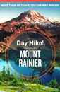 Day
Hike! Mount Rainier: The Best Trails You Can Hike in a Day, 3rd Edition
by Ron C. Judd. This guide features over 50 of the best trails for day
hikes. Each trail is rated and range from easy-moderated to
difficult-extreme. Also included are topographical maps, trail
descriptions and photographs.
Order now...
Day
Hike! Mount Rainier: The Best Trails You Can Hike in a Day, 3rd Edition
by Ron C. Judd. This guide features over 50 of the best trails for day
hikes. Each trail is rated and range from easy-moderated to
difficult-extreme. Also included are topographical maps, trail
descriptions and photographs.
Order now...
We appreciate your orders. They help keep
Go Northwest! online.
Northwest Books
from . . .
![]()
Shopping at
Go Northwest!
![]()
![]()
![]()
![]()